Drone weather forecast for flight planning, hour by hour
Pick a place and your drone: each hour of the National Weather Service forecast is judged against that drone's own wind rating and temperature range, with the best daylight window first.
Hourly drone weather forecast for the next 48 hours
Judge it under
Your browser reads the forecast for this check only, and the place is not saved.
The live forecast needs JavaScript, which is off in this browser. The sections below say what each number means and how the tool judges an hour.
Sample A forecast we recorded for Phoenix, AZ (center point), its first 12 hours. Type your ZIP code or city above for the next 48 hours where you fly.
Best flying weather from 7:00 AM until sunset, 5:25 PM. 5 mph, gusts about 11 mph. The maker rates the drone for 23.9 mph.
Phoenix, AZ (center point) · DJI Mini 4 Pro · Recreational rules · Recorded Sun, Nov 15, 2026, 6:19 AM MST
Best daylight window
Sun, Nov 15, 7:00 AM to 5:25 PM MST
Check10 h 26 min. Ends at sunset.
Now, 6:19 AM MST
Check
4 mph, gusts about 7 mph. The maker rates the drone for 23.9 mph.
This judges the weather only. For airspace, flight restrictions and the daylight rules, check the spot with Can I fly here?
| Hour | Wind at 200 ft | Temperature | Precipitation | Visibility and cloud | Kp | Daylight | State |
|---|---|---|---|---|---|---|---|
| Sun, Nov 15 | |||||||
| Now6:19 AM | 4 mph, gusts 7 mphRating 23.9 mph | 56 F | 0% | 10 mi, no ceilingCloud cover 11% | 0.33 | Night | Check |
| 7 AM | 5 mph, gusts 6 mphRating 23.9 mph | 56 F | 0% | 10 mi, no ceilingCloud cover 4% | 1.33 | Day | Check |
| 8 AM | 5 mph, gusts 8 mphRating 23.9 mph | 58 F | 0% | 10 mi, no ceilingCloud cover 1% | 1.33 | Day | Check |
| 9 AM | 5 mph, gusts 8 mphRating 23.9 mph | 64 F | 0% | 10 mi, no ceilingCloud cover 0% | 1.33 | Day | Check |
| 10 AM | 5 mph, gusts 9 mphRating 23.9 mph | 68 F | 0% | 10 mi, no ceilingCloud cover 0% | 1.33 | Day | Check |
| 11 AM | 5 mph, gusts 11 mphRating 23.9 mph | 70 F | 0% | 10 mi, no ceilingCloud cover 0% | 1.67 | Day | Check |
| 12 PM | 5 mph, gusts 9 mphRating 23.9 mph | 73 F | 0% | 10 mi, no ceilingCloud cover 2% | 1.67 | Day | Check |
| 1 PM | 5 mph, gusts 9 mphRating 23.9 mph | 75 F | 0% | 10 mi, no ceilingCloud cover 1% | 1.67 | Day | Check |
| 2 PM | 3 mph, gusts 8 mphRating 23.9 mph | 76 F | 0% | 10 mi, no ceilingCloud cover 2% | 1.67 | Day | Check |
| 3 PM | 3 mph, gusts 8 mphRating 23.9 mph | 76 F | 0% | 10 mi, no ceilingCloud cover 2% | 1.67 | Day | Check |
| 4 PM | 3 mph, gusts 6 mphRating 23.9 mph | 76 F | 0% | 10 mi, no ceilingCloud cover 2% | 1.67 | Day | Check |
| 5 PM | 2 mph, gusts 3 mphRating 23.9 mph | 74 F | 0% | 10 mi, no ceilingCloud cover 2% | 3.33 | Day | Check |
What the numbers are
- Wind at 200 ft
- Our estimate from the National Weather Service forecast at 10 m (33 ft): the sustained wind and the gust, times 1.3 while the sun is up and 1.5 when it is down, rounded up to whole mph. The factors are our own estimate, not an NWS figure. Caution when a gust reaches the maker's wind rating, no-go above 1.2 times it.
- Temperature
- The forecast temperature for the hour, compared with the maker's operating range, 14 to 104 F for this drone.
- Precipitation
- The chance of rain or other precipitation, and of thunder, for the hour. Shown, not judged: they do not change an hour's state, because no maker gives a number for them.
- Visibility and cloud
- Forecast visibility in statute miles, and the ceiling: the lowest cloud layer covering at least five eighths of the sky, in feet above the ground. No FAA number applies when you fly for fun: low visibility or low cloud in the forecast is a caution.
- Kp
- The planetary K-index of geomagnetic activity from NOAA's Space Weather Prediction Center: its estimate now, then the forecast for each hour's 3-hour block. Caution from Kp 5, the level NOAA calls a storm.
- Daylight
- Day when the sun is up at the start of the hour, from the sun's position at this spot. The best window counts only daylight hours.
- Sources
- National Weather Service grid forecast (office PSR), updated Sun, Nov 15 4:02 AM MST; NOAA Space Weather Prediction Center. Recorded once for this sample; your own check is read by your browser, and nothing is saved.
How each hour is judged: wind speed, Kp and temperature
Pick a place and a drone. Your browser reads the National Weather Service forecast for that spot and NOAA's Kp index, and the tool judges every hour against the drone's own figures with the same code as Can I fly here?, so the same place, drone, rulebook and hour get the same wind, Kp and temperature state in both tools.
No-go
Wind
Caution when the estimated gust at 200 ft reaches the maker's wind rating, No-go when it is more than 1.2 times the rating. When the forecast has no gust figure, the wind is unknown: it is never judged from the mean wind alone.
Caution
Kp
Caution from Kp 5, the level NOAA calls a geomagnetic storm.
Caution
Temperature
Caution when the forecast is outside the maker's operating range.
No-go
Visibility and cloud
under Part 107, a forecast below 3 statute miles is No-go. For recreational flights low visibility or low cloud is a Caution, since no FAA number applies.
Shown
Rain and thunder
the chance of each is shown for every hour and does not change the hour's state, because no maker gives a number for them. Look at the figure and decide.
Go
The best window
the longest run of daylight hours with the best state of the day. It ends at sunset, at the next change, or where the forecast ends, so you can plan a flight time inside it.
An hour the forecast has no figure for says “n/a”, and a source that did not answer says “not read”: the tool never fills a gap with a guess. Each hour shows its state as a word and a mark, with the item that decides it.
The best window keeps to daylight; when and how you may fly after sunset is in our guide to flying drones at night.
The facts on this page were last checked against the documents named under Sources on November 13, 2026.
Weather is half the answer
This page judges the weather only. Airspace, flight restrictions and the daylight rules are in Can I fly here?, for the same spot and drone.
Can I fly here?Wind speed and gusts at drone flight height
The forecast wind speed is the expected sustained wind 10 meters (about 33 ft) above the ground for that hour, and the National Weather Service defines sustained wind as the speed averaged over two minutes.
Ten meters with an open exposure is the standard height for surface wind.
The forecast gust is the strongest 3-second wind expected within a 2-minute span, also at 10 meters, and it is valid at the top of the hour. The NWS calls it a gust when the wind swings by 10 knots or more between peaks and lulls.
Part 107 allows flight up to 400 ft above the ground, far above the 33 ft the forecast is for. So the tool estimates the wind and the gust at 200 ft by multiplying the 10 m forecast by 1.3 while the sun is up and 1.5 after sunset, rounded up to whole mph. These two factors are our own estimate, not a National Weather Service figure, and the table says “Wind at 200 ft” so you know which number you read.
The grid gives wind in km/h, temperature in degrees C, and visibility and cloud height in meters; the tool converts them to mph, F, statute miles and feet. Each grid value carries its own valid period, and one value can cover several hours.
Your drone's wind rating and temperature range
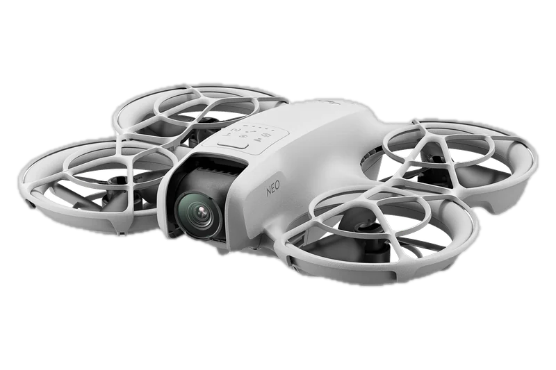
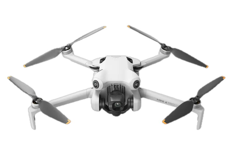
Makers rate wind in meters per second. DJI rates the Neo for wind up to 8 m/s (about 17.9 mph), the Mini 4 Pro up to 10.7 m/s (about 23.9 mph) and the Mavic 4 Pro up to 12 m/s (about 26.8 mph), and gives all three an operating range of 14 to 104 F (-10 to 40 C).
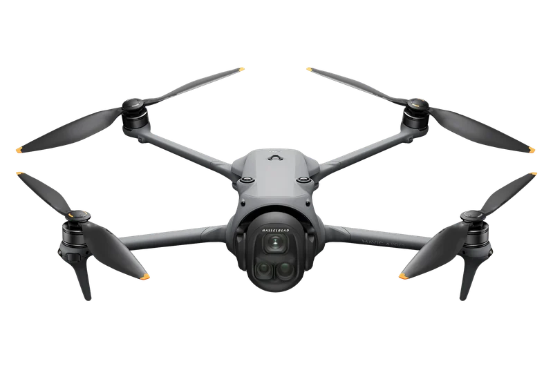
DJI Mavic 4 Pro
Caution from a 27 mph gust at 200 ft, No-go from 33 mph.
26.8 mph wind · 14 to 104 F
The tool holds each maker's figures converted to mph and F, and judges every hour against the drone you pick.
| Drone | Maker's wind rating | Caution from (gust at 200 ft) | No-go from (gust at 200 ft) | Operating range |
|---|---|---|---|---|
| DJI Air 3SDJI Air 3S specs page (U.S.) | 26.8 mph | 27 mph | 33 mph | 14 to 104 F |
| DJI Mavic 4 ProDJI Mavic 4 Pro specs page (UK English; no U.S. page) | 26.8 mph | 27 mph | 33 mph | 14 to 104 F |
| DJI Mini 5 ProDJI Mini 5 Pro specs page (UK English; no U.S. page) | 26.8 mph | 27 mph | 33 mph | 14 to 104 F |
| Antigravity A1Antigravity A1 specs page (U.S.) | 23.9 mph | 24 mph | 29 mph | 14 to 104 F |
| DJI Avata 2DJI Avata 2 specs page (U.S.) | 23.9 mph | 24 mph | 29 mph | 14 to 104 F |
| DJI FlipDJI Flip specs page (U.S.) | 23.9 mph | 24 mph | 29 mph | 14 to 104 F |
| DJI Mini 3DJI Mini 3 specs page (U.S.) | 23.9 mph | 24 mph | 29 mph | 14 to 104 F |
| DJI Mini 3 ProDJI Mini 3 Pro support page with specs and FAQ (U.S.) | 23.9 mph | 24 mph | 29 mph | 14 to 104 F |
| DJI Mini 4 ProDJI Mini 4 Pro specs page (U.S.) | 23.9 mph | 24 mph | 29 mph | 14 to 104 F |
| DJI Mini 4KDJI Mini 4K user manual v1.0 (English) | 23.9 mph | 24 mph | 29 mph | 32 to 104 F |
| DJI Neo 2DJI Neo 2 specs page (UK English; no U.S. page) | 23.9 mph | 24 mph | 29 mph | 14 to 104 F |
| HOVERAir X1 PROHOVERAir X1 PRO and PROMAX product page with specs | 23.9 mph | 24 mph | 29 mph | 14 to 113 F |
| Potensic ATOM 2Potensic ATOM 2 specs page | 23.6 mph | 24 mph | 29 mph | 32 to 104 F |
| DJI NeoDJI Neo specs page (U.S.) | 17.9 mph | 18 mph | 22 mph | 14 to 104 F |
- Caution from, No-go from: the estimated gust at 200 ft, in whole mph, at which an hour turns to Caution or No-go for that drone. The table holds 14 drones.
- Another drone: the two “Another drone” choices have no rating, so the wind and the temperature show as “no maker rating” rather than a guess. Look up your drone's own figures in its manual.
Kp index for drones: geomagnetic storms and GPS
The K-index measures disturbance of the horizontal part of Earth's magnetic field over a three-hour interval.
It runs from 0 to 9: 1 is calm, and 5 or more means a geomagnetic storm. Kp is planetary, the mean standardized K-index of 13 observatories between 44 and 60 degrees geomagnetic latitude, not a reading for your town.
NOAA's G scale ties storm levels to Kp, and lists satellite navigation problems only from G3 up:
| Storm level | Kp | Satellite navigation |
|---|---|---|
| G1 minor | Kp 5 | No satellite navigation problems listed |
| G2 moderate | Kp 6 | No satellite navigation problems listed |
| G3 strong | Kp 7 | Intermittent satellite navigation problems |
| G4 severe | Kp 8 (including 9-) | Satellite navigation degraded for hours |
| G5 extreme | Kp 9 | Satellite navigation degraded for days |
Geomagnetic storms disturb the ionosphere, and GPS receivers then cannot model it, which adds errors to the position. In calm conditions single-frequency GPS is good to about a meter; in a severe storm errors can grow to tens of meters or more. These errors usually show at high latitudes, and major storms can bring them to mid-latitudes too. NOAA's Space Weather Prediction Center says storms can disrupt satellite navigation systems in general, not only GPS. A drone, or unmanned aerial vehicle, such as the DJI Mini 4 Pro positions itself with satellite navigation: GPS, Galileo and BeiDou.
The tool's Kp caution starts at Kp 5, the level the Space Weather Prediction Center calls a storm: stricter than the scale's first navigation problems at Kp 7. Its Kp for now is NOAA's estimate, which updates every minute; for later hours it is the forecast for each hour's own 3-hour block.
Caution from Kp 5
From Kp 5 every hour turns to Caution: NOAA calls it a storm, and GPS can drift. Keep the drone close and watch its position.
Cold, rain, fog and extreme weather
The forecast temperature is the expected temperature for that hour, and the tool compares it with the maker's operating range: 14 to 104 F for the Neo, the Mini 4 Pro and the Mavic 4 Pro.
Cold matters before that limit too: DJI says Mini 4 Pro battery capacity drops a lot between 14 and 41 F, and the battery cannot be used below 14 F.
DJI tells Mini 4 Pro pilots not to fly in winds above 10.7 m/s, or in snow, rain or fog. In its notes on the vision system it adds: do not fly when it is rainy or smoggy, or when visibility is under 330 ft (100 m). Each hour in the forecast shows the chance of precipitation and of thunder, so you can see a wet or stormy hour coming, but they do not change the hour's state.
- Visibility: the distance at which a standard object can be seen and identified with the unaided eye.
- Ceiling: the height of the lowest cloud layer covering at least five eighths of the sky.
- Cloud cover: the expected share of the sky covered by opaque cloud for that hour, in percent.
Before a planned flight: what the FAA requires about weather
Before a Part 107 flight, the remote pilot must assess the operating environment, and that assessment must include local weather conditions.
Section 107.51 then sets its limits on visibility and on distance from clouds:
“The minimum flight visibility, as observed from the location of the control station must be no less than 3 statute miles.” “The minimum distance of the small unmanned aircraft from clouds must be no less than: (1) 500 feet below the cloud; and (2) 2,000 feet horizontally from the cloud.”
14 CFR 107.51(c) and (d), Operating limitations for small unmanned aircraft (eCFR)
What it means: at least 3 statute miles of flight visibility, and the drone at least 500 ft below and 2,000 ft sideways from any cloud. Flight visibility is what you see from the control station, not a forecast figure: the forecast tells you what to expect, and you check it where you stand.
The same section caps groundspeed at 87 knots (100 mph) and height at 400 ft above the ground, except near a structure. Part 107 sets no wind, temperature, rain, snow or fog limit. Its knowledge test covers aviation weather sources and how weather affects small drone performance: the Part 107 practice test has weather questions with their answers.
Flying for fun: the recreational exception, 49 U.S.C. 44809, lists eight conditions, and none of them is a weather, wind, visibility or cloud minimum. You must keep the drone within visual line of sight, your own or a co-located observer's, and follow the safety guidelines of a community-based organization developed with the FAA.
No wind limit in the rules
Its only weather limits are visibility and the distance from clouds. Wind, cold and rain are judged against your drone's own figures.
Part 107 practice testWhere the weather data comes from
The forecast comes from the National Weather Service API, read by your browser: the grid forecast for your spot, including wind speed, gusts, temperature, visibility, cloud height and the chance of rain and thunder, which the tool turns into hourly forecasts.
The NWS makes its forecasts on a grid of about 1.6 miles by 1.6 miles (2.5 km), each local forecast office on its own grid, and the raw grid forecast covers the next seven days. A place is matched to its office and grid cell by a lookup that can change now and then, so the tool looks it up on every check.
The national forecast database is updated at most once an hour, currently by 45 minutes past the hour. Each grid response says when it was last updated, and the tool shows that time under the table.
The Kp comes from NOAA's Space Weather Prediction Center: its 1-minute estimate, and its forecast of 3-hour Kp values, each marked observed, estimated or predicted, with the NOAA scale level. Final K values are set after fixed three-hour blocks (00-03, 03-06 and so on to 21-24 UTC).
A check asks no more than four weather addresses, all at api.weather.gov and services.swpc.noaa.gov, with the place rounded to 4 decimals (about 36 ft, or 11 m). You need no account for access to weather data here: nothing is saved, and nothing is asked before you act on the form.
Nothing is saved
No account, no cookies to the weather services, and the place you check is not stored.
Related pages
Other Windhorse tools and guides for the same flight.
Coming next: a page for each of the other drone models with its full specifications.
Questions about drone weather
What is too windy for a drone?
Wind above your drone's own maker rating: 8 m/s (17.9 mph) for the DJI Neo, 10.7 m/s (23.9 mph) for the Mini 4 Pro, 12 m/s (26.8 mph) for the Mavic 4 Pro. Mind that the forecast is for 33 ft: the tool estimates the gust at 200 ft, says Caution when it reaches the rating and No-go above 1.2 times it.
Can you fly a drone in the rain?
No FAA rule forbids it: Part 107 sets no rain limit, and the recreational exception has no weather condition. But DJI tells Mini 4 Pro pilots not to fly in rain, snow or fog. The tool shows each hour's chance of rain and of thunder.
Can you fly a drone in the snow or the cold?
Only within the maker's operating range, which is 14 to 104 F for the DJI Neo, Mini 4 Pro and Mavic 4 Pro. DJI tells Mini 4 Pro pilots not to fly in snow, and says its battery loses a lot of capacity below 41 F and cannot be used below 14 F.
What Kp index is safe for drones?
Kp runs from 0 to 9, and 5 or more is a geomagnetic storm (G1). Storms add GPS errors, and NOAA's scale lists satellite navigation problems from G3, which is Kp 7. The tool says Caution from Kp 5.
Does Part 107 have weather minimums?
Yes: at least 3 statute miles of flight visibility, the drone 500 ft below and 2,000 ft sideways from clouds, and a check of local weather before the flight. It sets no wind, temperature or rain number.
Do recreational flyers have weather rules?
There is no weather number in 49 U.S.C. 44809. Keep the drone within visual line of sight and follow a community-based organization's safety guidelines.
How often does the drone weather forecast update?
The national forecast database is updated at most once an hour, and the tool shows the time of the forecast it read. NOAA's live Kp chart updates every minute, and its 3-day space weather forecast is issued every 12 hours.
Sources
Documents are named, not linked. Each was read on November 13, 2026; the FAA rules and 49 U.S.C. 44809 were read again on November 13, 2026.
The forecast
- National Weather Service API Web Service documentation: the grid, its seven days and the lookup of office and grid cell
- NWS National Digital Forecast Database element definitions: wind, gust, temperature, visibility, ceiling and sky cover
- NOAA MDL Virtual Lab, NDFD Web Services: how often the database is updated
- National Weather Service glossary, entries Sustained Wind, Gust and Maximum Sustained Surface Wind
- api.weather.gov gridpoint response for Spicewood, TX (recorded November 13, 2026): units, valid periods and update time
Kp and space weather
- NOAA Space Weather Prediction Center, Planetary K-index
- NOAA Space Weather Prediction Center, “The K-index”
- NOAA Space Weather Scales, geomagnetic storms
- NOAA Space Weather Prediction Center, Space Weather and GPS Systems
- NOAA Space Weather Prediction Center, Geomagnetic Storms
- NOAA Space Weather Prediction Center, 3-Day Forecast, and its planetary K-index forecast feed
Rules
- 14 CFR 107.49, 107.51 and 107.73, and Part 107 as a whole (eCFR, up to date as of November 10, 2026)
- 49 U.S.C. 44809, Exception for limited recreational operations of unmanned aircraft (United States Code, 2024 edition)
Drones
- DJI Neo specs, DJI Mini 4 Pro specs and DJI Mavic 4 Pro specs (DJI's UK site; it has no U.S. page)
- DJI Mini 4 Pro User Manual v1.0 (September 2023): flight environment, low temperature and vision system notes
- Each other drone's rating: the maker's document named under its row in the ratings table
Photos: DJI press images. USGS (public domain).